Explained: What caused heavy rainfall in Northwest India
The prime reason is the rare but not abnormal confluence of monsoonal winds with western disturbances. But is climate change also at play?
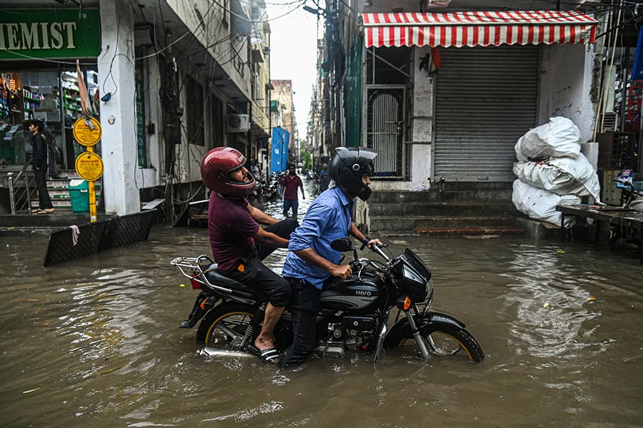
 A man rides his bike through a flooded street after heavy rains lashed New Delhi. Image: Kabir Jhangiani/NurPhoto via Getty Images
Between July 8 and 10, some areas of Northwest India, including New Delhi, Himachal Pradesh, Jammu and Kashmir, Uttarakhand, Punjab, and Rajasthan witnessed heavy to very heavy rainfall leading to landslides, flash floods, and damage to infrastructure. More than 40 people have lost their lives across these regions, and about 500 tourists continue to remain stranded in Himachal Pradesh, according to news reports.
Over 24 hours, The Safdarjung Observatory, the main weather station in New Delhi, recorded 153 mm of rain until 8.30 am on July 9, according to PTI. In four decades since July 1982, this is the highest rainfall for a single day the region has recorded.
The situation so far
As of today, Himachal Pradesh—so far the worst-hit state—and parts of Punjab and Haryana continued to witness rainfall. On Monday, the Indian Meteorological Department (IMD) issued a red alert—meaning ‘take action’—for several districts of Himachal Pradesh. Today, it is on an orange alert—meaning ‘be prepared’. The IMD has also issued alerts for flash floods and landslides in the state. Uttarakhand will remain on orange alert till Wednesday, July 12.
Meanwhile, authorities have started evacuating people from low-lying areas in Delhi, as the Yamuna river breached the danger mark on Monday, with Haryana releasing more water from the Hathnikund barrage.
What the authorities say
By the end of June, the monsoon was 10 percent below the normal level. The IMD—the principal agency responsible for weather forecasting—had predicted a normal rainfall in July. However, the recent rainy spell has met the deficit for the entire country, according to the IMD. Water levels in the country’s reservoirs are also improving, the Central Water Commission told PTI.


